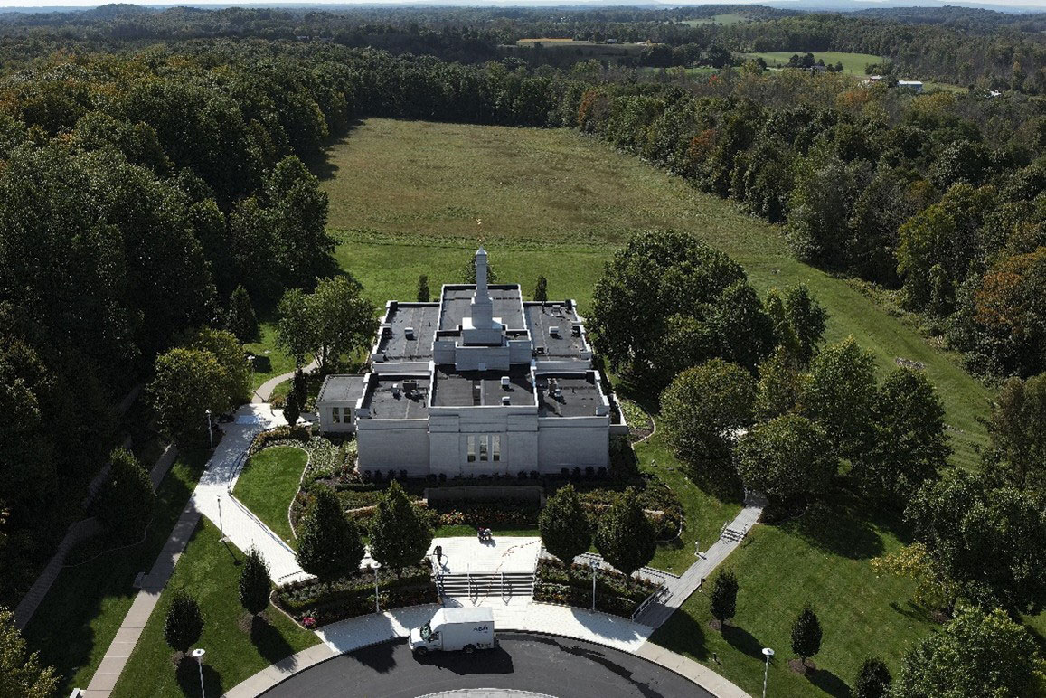
Temple, Palymra NY
Our team conducted a complete boundary survey to ALTA specifications, along with a detailed one-foot topographic survey for over 75 acres of land. We located and mapped both underground and visible utilities, including sanitary and drainage inverts. Additionally, we identified and documented hardscape and softscape site features, as well as parking layouts. Coordination with facilities and maintenance ensured seamless site access in accordance with religious services. A combination of total station/traditional survey, GNSS, and reality capture using terrestrial 3D laser scanning and sUAS photogrammetry was used.

Hydroelectric Plant Upgrade, Auburn NY
The city of Auburn, NY, has two hydroelectric facilities, Mill Street and North Street, and the former needed an upgrade and repair job. Measurements of existing conditions were needed to replicate the area for the current turbine to fit. This would help to inform pieces of the project such as the overall design as well as how much rock was necessary to excavate.
We were able to provide the precise measurements to map the area, answering questions about the project and saving time and guesswork.

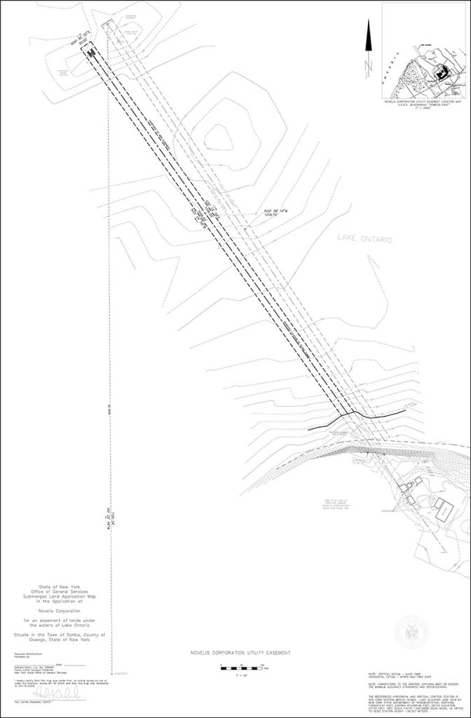
Novelis Waterline Project, Lake Ontario NY
Our team created a Submerged Land Application Map per NYS OGS specifications for an easement. We located a submerged water intake extending 1,200 feet into Lake Ontario at a depth of 25 feet. A detailed 1-foot bathymetric survey was performed across 17 acres of Lake Ontario, along with a 1-foot topographic survey covering 22 acres of road and adjacent site features. Utilizing a combination of sonar, terrestrial laser scanning, GNSS, sUAS, and total station technology, we ensured precise data collection. Coordination with security personnel was also conducted to facilitate site access and required training.

Monroe Community College, Rochester NY
Our team conducted an aerial photogrammetry survey using sUAS for a detailed façade inspection. We performed 3D laser scanning to ensure accurate planar alignments and BIM modeling. A Revit model was created to visualize the structure, while a cloud-hosted point cloud provides access for measurements and image analysis. Planar alignments were produced for each building face, and the project was georeferenced for seamless integration with existing and future site developments.

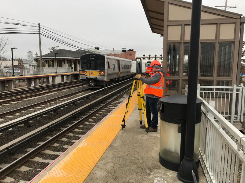
Subway Station Rehab, New York NY
Our team conducted platform and track surveys for 28 subway stations and street surveys for 32 sites. We met 2SR Survey Requirements and delivered results in compliance with NYCT CADD Standards. A total of 60 survey baselines were set and published for future project control. The surveyed subway stations were located across the Bronx, Brooklyn, Manhattan, and Queens. Site surveys were performed in coordination with flaggers and general orders, ensuring no service outages. Utilizing terrestrial LiDAR 3D scanning, we collected precise data and provided additional data extraction as needed. Differential leveling techniques were employed to maintain vertical datum accuracy with respect to established baseline benchmarks.